Now that the most efficient trail has been identified, it’s time to start on the trail. During the journey, it is important to always keep your
bearing and also check your map often. While trails in popular areas are clearly marked, unpopular trails in the backcountry are not. So it is
important to make sure you are heading towards the correct bearing instead of just the general direction. You’ve seen bearing mentioned multiple
times, so what is a bearing?
A bearing is a measurement of direction between 2 points and is normally given by a degree. There are many ways to obtain a bearing, with two
being the most common. The first method is to obtain a bearing using a given landmark, such as a hill or a tree. The second is to find a bearing
between two objects on a map. The section below breaks down the steps for each method.
|
Bearing of a Landmark
To obtain a bearing of a landmark, follow these simple steps:
- Point the Direction of Travel arrow to the landmark you would like to obtain the bearing for.
- Rotate the bezel until the magnetic needle is “boxed” within the Orienteering Arrow.
- The bearing for the landmark is the degree under the Direction of Travel.
|
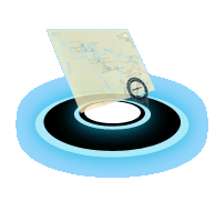
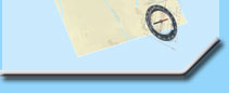
Bearing using two points on a map
To obtain a bearing between two points on a map, ensure that the map has been properly oriented. Once oriented, follow the procedures below:
- Locate the two points in which you would like to obtain the bearing for and draw a straight line connecting both points.
- Align the line drawn on the map with the Direction of Travel arrow on your compass.
- Rotate the bezel until the magnetic needle is “boxed” within the Orienteering Arrow.
Note: Do not move the map as the map has already been oriented.
- The bearing between the two points is the degree under the Direction of Travel.
Orienting the map should be the first step in determining the bearing; however if this was not done, the user must compensate for magnetic
declination. The declination value must be added or subtracted from the bearing depending on your location.
|
Other Orienteering Techniques
Aside from obtaining your bearing, there are other techniques that would allow the scout to stay on track and reduce the risk of getting lost.
These techniques are noted below:
- Attack Point
- Handrails
- Thumbing
- Points of Three
|
Attack Points
While similar to an bearing, an attack point allows the scout to focus more on landmarks instead of a degree. Attack points are permanent
landmarks that are easily identifiable on the ground. These could be manmade items such as bridges and buildings, or nature such as waterfalls,
or mountains. It should be stressed that attack points be used in conjunction with bearings as scouts may select a landmark such as a mountain
and hike towards a different mountain because their step was off and was confused because the mountain around the area all look the same.
|
Handrails
Handrails or Hand-railing as the technique is called, is a technique used by scouts that are required to keep a fast pace or is in a situation
where attack points could not be used, such as fog. Hand-railing utilizes the existing features of the environment and allows the scouts to follow
the feature to prevent straying from the target. This may require the scout to cover more ground, but because the scout will not be required to
check their bearing, it also allows the scout to move at a quicker pace. This method can be used on the following features:
- Rivers
- Canyons
- Paths or Roads
- Overhead Wires
- Edge of Forests
- Clif Edges
The technique is extremely easy to implement, but the scout should implement this method prior to starting their trek. The scout should plot out
their trek on a map and ensure they are at the current location. In addition, while using this technique, scouts should also identifying different
attack points along the trek to ensure they are on the proper path. Without the use of Attack Points, scouts may overshoot their target and loose
valuable time.
|
Thumbing
While the techniques mentioned above are used while the scout is traveling, the thumbing technique is a technique that is used on the map. The
purpose of the thumbing technique is to identify the scout’s last known location to prevent the scout from losing their location on their map.
In order to use this technique, the map would have to be folded so only a small location is exposed. The scout will then place their thumb on
their location before traveling to the next location. Once they have arrived, the scout can use their previous location which is being marked
with the scout’s thumb as a reference to determine if they are off.
|
Points of Three
Traveling in a straight line in the wilderness is extremely hard. Individuals pacing will change while they are traveling and may steer off their
original bearing. The easiest way to check and correct for this is following the Points of Three technique. This is an extremely easy technique
and can be deployed when the scout is traveling. When a scout is required to travel in a straight line, whether on an orienteering course or in
the wilderness, the scout can check whether they are traveling in a straight line by locating the following items.
- Locate the attack target – (Let's call this Point A.)
- Locate the scout’s original position – (Let's call this Point C)
- Ensure that the scout (Let's call this Point B) is aligned with Point A and Point C which will ensure the scout is on a straight line.
The is an extremly easy technique that can be implemented quickly and easily and acts as a simple check to ensure the scout is traveling in a
straight line. This is extremly important as we do not walk in a straight line and even the a small degree of error can add to distance between
the scout and their target.
|