


|
|
|
Quick Stats
|
|
|
Name:
|
Beaudry Loop
|
Trail Type:
|
Loop
|
Difficulty:
|
Moderate
|
Season
|
Late Fall to Early Spring
|
|
|
Trail Head:
|
3110 Beaudry Terrace, Glendale, CA 91208
|
River Crossings:
|
None
|
Open To:
|
Hikers, Runners, Pets, and Bikes
|
Agency:
|
Glendale Parks & Recreation
|
|
|
Elevation Gain:
|
1,515 Feet
|
Fees and Permits:
|
None
|
Parking:
|
Free: Street
|
Restrooms:
|
None
|
|
|
Length:
|
5.5 Miles
|
Cell Signal:
|
Yes
|
Alerts:
|
None
|
PokéStops:
|
Three
|
|
|

Download GPX File
|
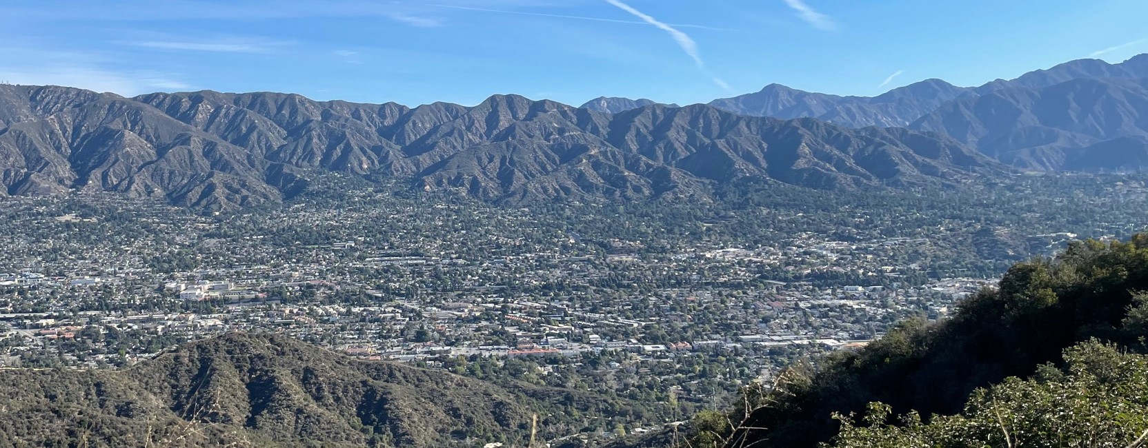
Located in the Verdugo Mountain Range, the Beaudry Motorway Loop is a 6 mile loop trail in the city of Glendale and summits Tongva Peak that sits 2,656 feet above sea level. The Beaudry Loop trail isn't as popular as the other hikes in southern California such as Mt. Lowe, or Chantry Flats; however don't let that deter you from this gem.
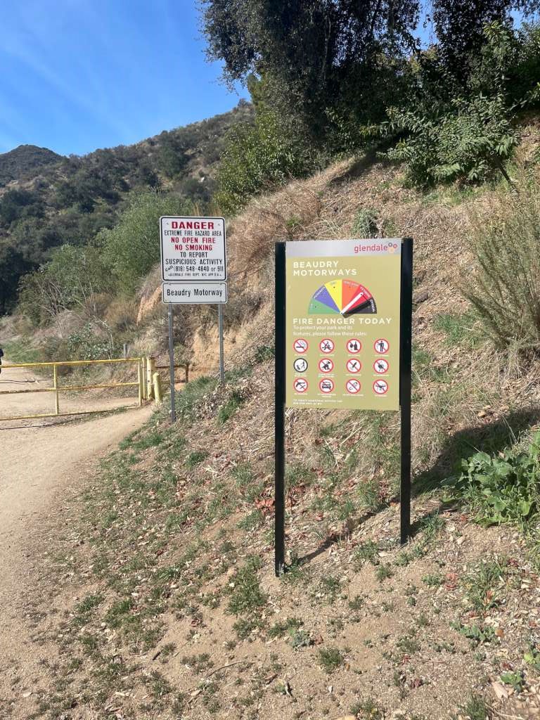
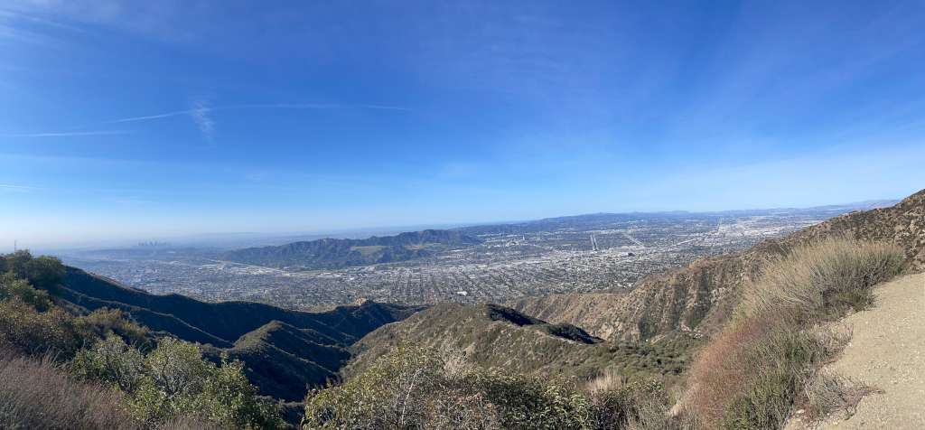
The trail starts a quarter mile from the corner of Beaudry Terrace and Beaudry Blvd. Park your vehicle on the street and head down on Beaudry North Motorway and you will be greeted with the trailhead gate approximately a quarter mile down. The route is entirely on dirt service roads and is very well maintained. This makes navigation easy with only a few forks along the way. As you work your way up the mountain (yes it's all incline one way and decline the other) you are awarded with scenic overlooks of the City of Burbank and Glendale on one side with the San Gabriel mountains on the other. If it's a clear day, you can see downtown LA and even Catalina island if you're lucky.
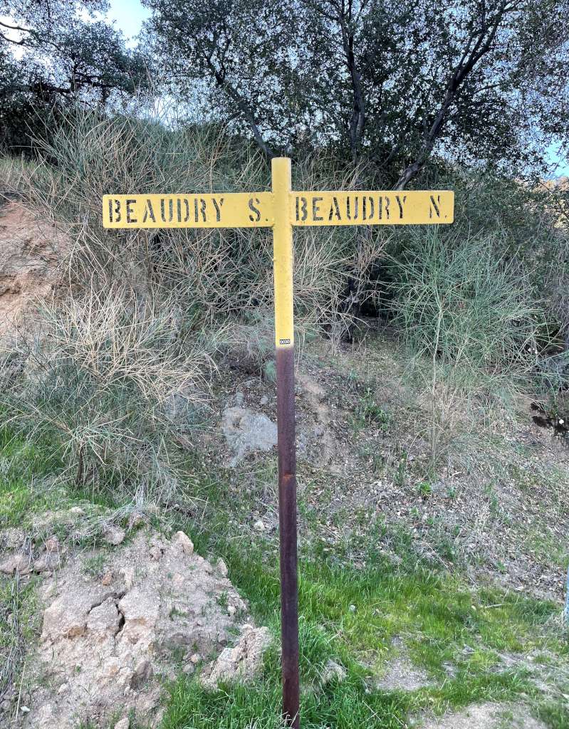
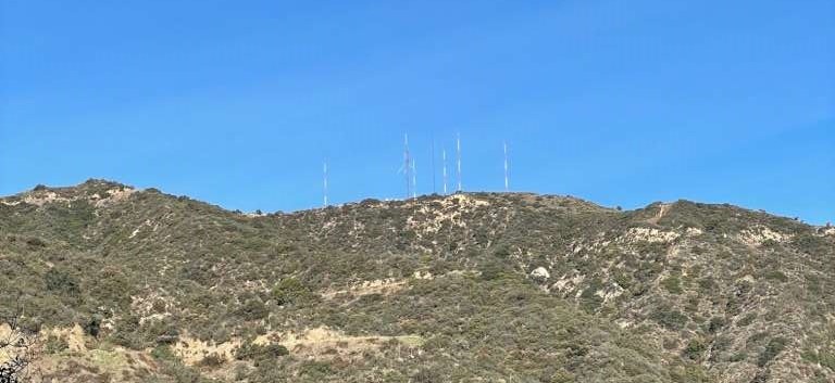
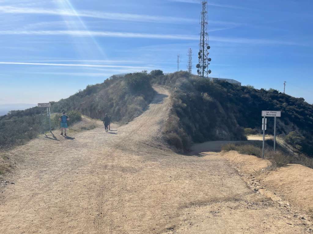
After passing the trailhead gate, continue heading south and in .3 miles you will hit the first fork with one way heading north (right) on Beaudry North Motorway while the other heading south (left) on Beaudry South Motorway. Since this is a loop trail, it doesn't really matter which route you take; however hikers noted that the south motorway is a bit more strenous since the elevation gain is a bit more aggressive. The north motorway is a bit easier but longer and also provides views of the broadcasting tower which resides on the summit. Since we like seeing our destination, we decided to take the north motorway and headed off.
The first half miles after the Beaudry North/South split is pretty standard with sights of the canyon walls covered in dried grass, and a few tall oak and eucalyptus trees. Enjoy the shade and breeze while you can because those are going away soon. The higher you go the smaller the trees and the more you are exposed to the sun. Because of this, it is recommended that you go early in the morning. Keep your eyes on the prize, which in this case are the broadcasting towers. After completing 1.5 miles from the fork, trees will become scarce, but that gives way to sweeping vistas, wildflowers as well as a rusty water tank.
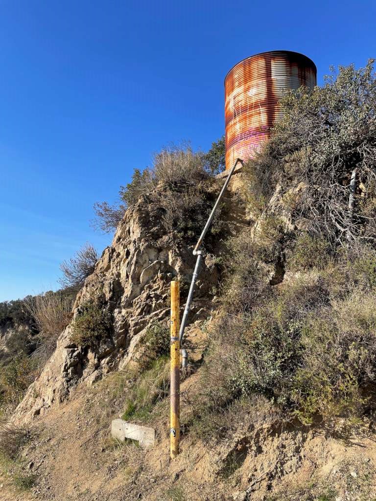
After passing the rusty water tank, the trail will fork with the Beaudry Motorway to the left and the Verdugo Motorway on the right. Continue on the Beaudry Motorway and keep gaining elevation. With Tongva Peak only a quarter mile away, views of Downtown LA will start coming into view and the broadcasting towers will look much closer. In case you didn't know, these broadcast towers are used by KROQ-FM. The towers are of course gated off but right beside the towers is a marker marking the top of Tongva Peak and a bench to take in the view.
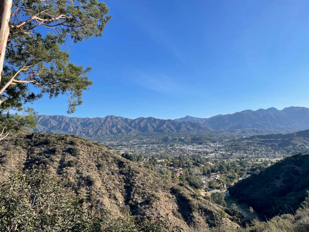
After taking a break and the sights, it's time to head back. To complete the loop head south from Tongva Peak. Another radio station which sits on top of Mount Thom will come into view. As you head towards Mt. Thom, another fork can be seen. The left path connects to Beaudry South Motorway while the right path connects to Las Flores Motorway. Head left onto Beaudry South and you will arrive back to where you started at the Beaudry North and South split. As you descend back down into the canyon, don't forget to take in the view of Downtown LA and the San Gabriel Valley basin
|
|
|
Useful Tips:
1. Hike early in the morning and during cool seasons (late fall - early spring)
2. Hiking shoes are recommended as the trail is rocky and the trail by at the summit has loose gravel
3. Wear sunblock as there are very little shade and you are exposed to the sun especially later in the day
4. No smoking allowed - Sign noted that "Smokers are fed to bears"
5. Loop takes approximately 2.5 hours
|
|